|

|
Back to Home page.
|
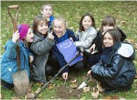 |
 Group members helped
children from
Thriplow
Primary School to understand more
of the process
of finding out about the past. They looked at the results of
our earlier resistivity survey and then scanned the same area in the school
playing field with a metal detector. The children found several nails and
bottle tops but were really excited to find a Canadian coin. Group members helped
children from
Thriplow
Primary School to understand more
of the process
of finding out about the past. They looked at the results of
our earlier resistivity survey and then scanned the same area in the school
playing field with a metal detector. The children found several nails and
bottle tops but were really excited to find a Canadian coin.
|
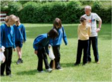 |
The children were also helped to survey
a straight road over an imaginary hill and then plan out the grid system of
a Roman town. They lined up along the strings of a groma as the
Romans would have done. |
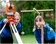 |
When their lines were checked with a
modern theodolite the groma was found to have been surprisingly accurate. |
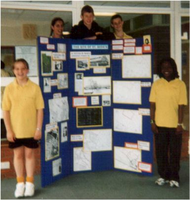 |
The Thriplow group was also involved in
supporting pupils from St Bede's Inter-Church Comprehensive School
Cambridge. This project involved researching the development of
the site of the school, using old maps and documents, aerial photographs,
newspapers and oral evidence.
The work culminated in a wall display and a leaflet with a time line. |
| The Thriplow Landscape Research Group have given talks to local
history societies. They have also exhibited at the Millenium displays in Sawston and Whittlesford and at the Cambridge Antiquarian Society
annual conference. Regular updates are published in the Thriplow
journal. |
|
Links to more details |
|
Documentary evidence |
Plane table surveying |
|
Place name analysis |
Resistivity surveying |
|
Aerial photography analysis |
Dowsing and pond dipping |
|
Geology |
Courses and visits |
|
Soil sampling |
Community links |
| |