|
|
| Back to home page. |
 |
Landscape archaeology is the study of features visible on the surface. What we see is the result of a series of interconnecting systems, evidence being found in many different kinds of archaeology. Despite the fact that there has probably been continuous occupation of the area around Thriplow for thousands of years we only have documentary evidence for about a thousand years. Listed below are our principle sources. |
|
|
 |
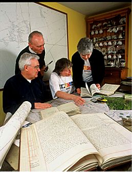
In 1846 R.C. Neville excavated the
tumulus at Thriplow. His original notebooks along with a copy of his
book Sepulchra Exposita are held in the Museum of
Archaeology and Anthropology in Cambridge. Terry Hoare and Sharon
Webb from the museum helped some of the group to examine these, together
with some of the pottery and flint finds from the site.
|
| Links to more details.... | |
| Documentary evidence | Plane table surveying |
| Place name analysis | Resistivity surveying |
| Aerial photography analysis | Dowsing and pond dipping |
| Geology | Courses and visits |
