|
|
|
| Back to Home page. | |
 |
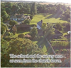
This
view of the school and adjacent field shows clearly the ditched area which
was surveyed by the group. Long shadows created by the evening sun
emphasise the shape of the ground. The vicar, Jim Mynors, took members up the church tower, from where there was a breathtaking view of the parish of Thriplow and surrounding land. |
| We visited these other sites in order to make comparisons and to extend our understanding of the Thriplow landscape:
*Fowlmere |
|
